Widgetized Section
Go to Admin » Appearance » Widgets » and move Gabfire Widget: Social into that MastheadOverlay zone
More early snow stokes the question: ‘Could Vail open early?’
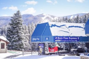
It’s dumping again Monday morning in EagleVail, right at the base of Beaver Creek ski area, and another half a foot or so of new snow has fallen since Sunday night at Vail and Beaver Creek, which are still nearly three and four weeks away from opening to the public, respectively.

But swirling just as heavily as all the early-season snow are the rumors that one or both of our local ski resorts could open for the season earlier than scheduled. Vail is set to open Friday, Nov. 15, with skiing out of the village and Lionshead thanks to a new, multi-million-dollar, state-of-the-art snowmaking system and all the natural snow of late. That date could get bumped up.
Beaver Creek, which has been making snow on the Birds of Prey World Cup course (Dec. 5-8), is set to open Wednesday, Nov. 27.
This week, four more resorts join the three already open for the season, with Wolf Creek cranking up its lifts on Halloween (Thursday, Oct. 31), Eldora opening two weeks early on Friday, Nov. 1, Monarch Mountain opening three weeks early on Friday as well and Winter Park announcing its earliest ever opening day on Saturday, Nov. 2.
Keystone (6 new), Arapahoe Basin (4 new) and Loveland (5 new) are all up and running already and looking forward to more fresh snow from yet another storm Monday night through Wednesday.
Copper Mountain and Breckenridge are scheduled to open on Friday, Nov. 8.
“The snow should end on Monday morning, then a second storm will bring 2-6 inches of snow from Monday night through Wednesday along with very cold air on Wednesday,” Opensnow.com meteorologist Joel Gratz wrote Monday morning.
“Looking ahead, dry weather is likely from October 31 through about November 6 and then it’s possible that a storm might sneak into Colorado after that,” Gratz added.
The National Weather Service on Monday issued the following Winter Storm Warning:
ELKHEAD AND PARK MOUNTAINS-GORE AND ELK MOUNTAINS/CENTRAL MOUNTAIN VALLEYS-INCLUDING THE CITIES OF COLUMBINE, HAHNS PEAK, TOPONAS, ASPEN, VAIL, AND SNOWMASS
150 PM MDT MON OCT 28 2019
…WINTER STORM WARNING IN EFFECT FROM MIDNIGHT TONIGHT TO 6 PMMDT WEDNESDAY…
* WHAT…HEAVY SNOW EXPECTED. TOTAL SNOW ACCUMULATIONS OF 5 TO 12 INCHES WITH UP TO 16 INCHES POSSIBLE AT HIGHEST ELEVATIONS AND WEST-FACING SLOPES. WIND GUSTS UP TO 40 MPH.
* WHERE…ELKHEAD AND PARK MOUNTAINS AND GORE AND ELK MOUNTAINS/CENTRAL MOUNTAIN VALLEYS.
* WHEN…FROM MIDNIGHT TONIGHT TO 6 PM MDT WEDNESDAY. SNOWFALL WILL BEGIN AROUND MIDNIGHT, INCREASING OVERNIGHT AND THROUGH TUESDAY. HEAVIEST SNOWFALL SHOULD COME LATE TONIGHT THROUGH TUESDAY. SNOWFALL WILL CONTINUE TUESDAY NIGHT AND WEDNESDAY THOUGH SLOWLY DECREASING IN INTENSITY.
* IMPACTS…TRAVEL WILL BECOME VERY DIFFICULT, ESPECIALLY OVER THE HIGH MOUNTAIN PASSES. EXPECT HAZARDOUS WINTER DRIVING CONDITIONS ON ALL ROADS WITH SNOW-PACKED AND ICY ROADS AND VERY POOR VISIBILITY IN HEAVY SNOW AND OCCASIONAL BLOWING SNOW. THE POOREST DRIVING CONDITIONS ARE EXPECTED OVER RABBIT EARS AND VAIL PASSES. A DETAILED MAP OF THE SNOWFALL CAN BE FOUND AT: WWW.WEATHER.GOV/GJT/WINTER.
PRECAUTIONARY/PREPAREDNESS ACTIONS…
IF YOU MUST TRAVEL, KEEP AN EXTRA FLASHLIGHT, FOOD, AND WATER IN YOUR VEHICLE IN CASE OF AN EMERGENCY.
THE LATEST ROAD CONDITIONS FOR THE STATE YOU ARE CALLING FROM CAN BE OBTAINED BY CALLING 5 1 1


