Widgetized Section
Go to Admin » Appearance » Widgets » and move Gabfire Widget: Social into that MastheadOverlay zone
Remembering John Fielder and his endless photographic fight to conserve Colorado’s wild place
I didn’t know photographer John Fielder was battling pancreatic cancer until I received the following email statement on Saturday from Colorado Gov. Jared Polis and then read this story in the Summit Daily News:
“I am saddened by the loss of John Fielder, who captured Colorado’s iconic beauty during his 50 years as a nature photographer. His unique talent and work allowed him to showcase our state to millions across the world and he will be dearly missed,” said Governor Polis. “My condolences to his family and friends. I hope that we can all follow his example to appreciate and preserve our outdoor lands. I last saw John two weeks ago at the opening of the ‘REVEALED: John Fielder’s Favorite Place’ exhibition at History Colorado. On behalf of the state, I thanked him for donating his life works to History Colorado.”
I never met Fielder, but, like most Coloradans, admired his work from afar. I indirectly “worked” with him the last couple of years on getting the word out about a proposed Aurora and Colorado Springs’ dam in the Homestake Creek Valley near Vail that would create what’s being called Whitney Reservoir – another transmountain water diversion to the Front Range.
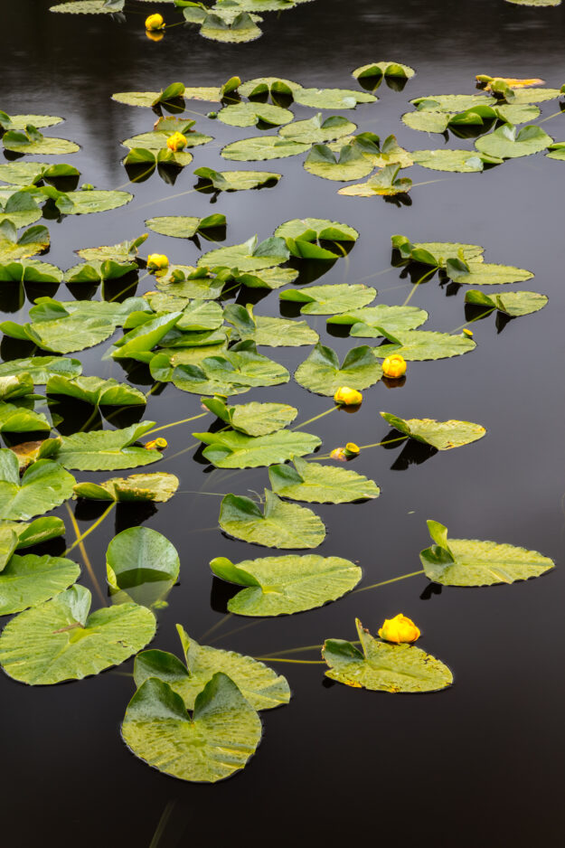
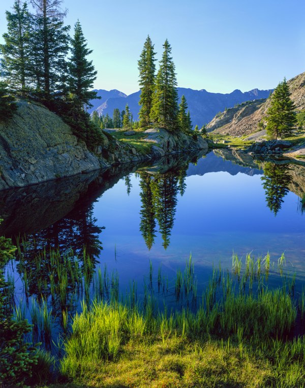
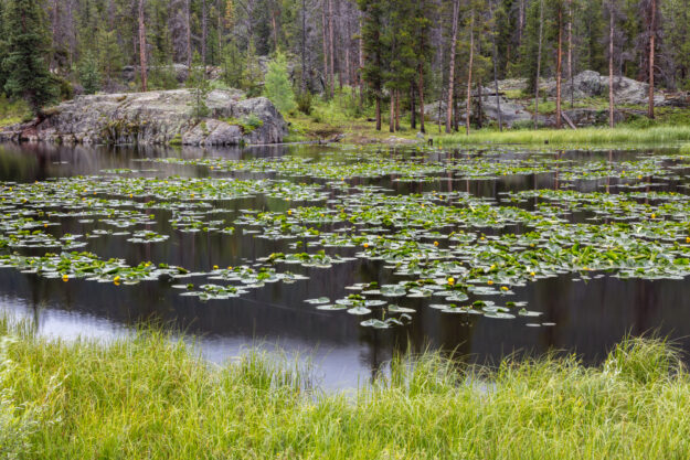
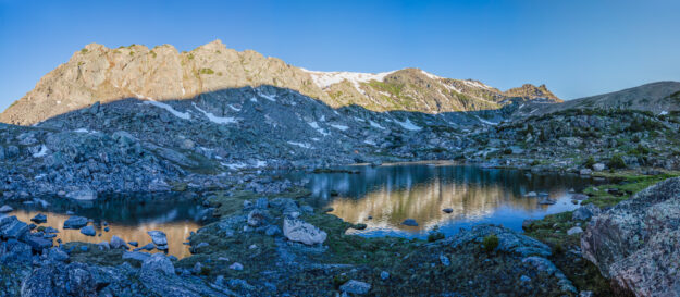
Fielder had offered photos of the ancient fens that would be inundated in the proposed reservoir area and of the nearby Holy Cross Wilderness Area to the invaluable Writers on the Range syndicated column network, which prompted me to write a piece for them in exchange for using the Fielder photos with stories on my website and in other publications, including the most recent issue of Vail Valley Magazine. Here are those photos again, followed by my magazine piece, which more recently ran in the Vail Daily.
Please honor John’s work by doing all you can to conserve these incredible places.


Water war at Whitney: How history and hydrology are colliding on the upper Eagle River
Mark Twain may or may not have actually said it first – “Whiskey is for drinking; water is for fighting!” – but even if he didn’t, the high-altitude wetlands, ancient fens, and mountain meadows of southeastern Eagle County, peaceful as they seem now, are all places that fit perfectly within what’s become the West’s most descriptive and divisive aphorism of the last century.
The area is essentially a triangle of mostly federal land that stretches from Homestake Reservoir at its southwest corner to Ski Cooper on its southeast and comes together at a perfect point north of the tiny former mining town of Red Cliff called Battle Mountain Pass. Named for a legendary, if not mythical, battle between Ute and Arapaho Indian tribes in 1868, Battle Mountain Pass is a perilous place at 9,267 feet along U.S. Highway 24 connecting Vail to Camp Hale.
Now a newly named national monument, Camp Hale is as essential to Vail’s origin story as Pete Seibert himself – the late U.S. Army 10th Mountain Division ski trooper who trained for winter warfare at Camp Hale, was badly wounded fighting the Nazis in the mountains of Italy, and returned to Colorado to envision and then execute the most improbable sheep-pasture to megaresort ski dream in the history of outdoor recreation: the creation of Vail in 1962.
But if Vail was born from war, or at least dreamed up by former warriors, and the surrounding mountain valleys and peaks were shaped by conflicts as ancient as Native American territorial turf wars and as modern as pistol-packing mining, railroad and real estate clashes of the late 19th century, the triangle of land that includes Camp Hale National Monument, the headwaters of the Eagle River, and the Homestake Creek Valley to the west is now the epicenter of what’s shaping up to be an epic water war pitting the vast majority (80%) of Colorado’s population on the state’s booming Front Range against Western Slope interests and, some would say, nature itself.
“These treasured lands tell the story of America,” President Joe Biden said at Camp Hale in October, designating it with the stroke of a pen as part of the new 53,800-acre Camp Hale-Continental Divide National Monument. “For thousands of years tribal nations have been stewards of this sacred land, hunting game, foraging for medicinal plants and maintaining a deep spiritual bond with the land itself. By the 1800s, mining activity and the federal government drove out indigenous tribes from their homes …”
Nearly two dozen Native American tribes, including Utes who used to hunt and fish in the meadows and mountains around Camp Hale, now hold some of the most senior water rights to nearly a quarter of the water flowing in the endangered Colorado River. The overallocated and overutilized Colorado, which supplies 40 million residents of seven states in the Southwest, is now subject to intense wrangling over future supplies as the federal government forces cuts to consumption in order to keep hydroelectric dams operating at Lake Powell and Lake Mead.
The Upper Basin states of Colorado, Utah, Wyoming and New Mexico insist they never come close to using the 7.5 million acre-feet per year allocated them under the terms of the increasingly anachronistic Colorado River Compact of 1922, which serves up an equal share to the Lower Basin states of California, Arizona and Nevada. But Mother Nature, with a sharp shove from manmade climate change, has provided just 13.4 million acre-feet a year of Colorado River water over the last 20 years of a megadrought the Southwest has not experienced for more than a millennium. With water consumption around 15 million acre-feet a year by the seven compact states and Mexico, that adds up to a more than 33-million-acre-foot deficit since 2000.
[An acre-foot, equal to about 326,000 gallons of water, is enough to cover one acre of land — about the size of a football field — one foot deep in water. An acre-foot is enough water to supply two to three average-sized households for a year.]
Which brings us back to the relatively modest amount of 20,000 acre-feet that Colorado Springs, Colorado’s second largest city at 478,961people, and Aurora, Colorado’s third-largest city at 386,261 people, want to take from somewhere near Camp Hale in the upper reaches of the Eagle River, which bisects Eagle County before flowing into the Colorado in the western part of the county near Dotsero. That relatively modest amount of water – in the grand scheme of the once-mighty river’s dramatically dwindling flow – might seem like the proverbial drop in the multi-million-acre-foot bucket, and it’s water the two cities first claimed all the way back in 1952.
But in that year, a decade before Vail opened with absolutely no artificial snowmaking, the combined land and ocean temperature around the globe was 1.52 degrees Fahrenheit cooler, which scientists attribute to rapidly rising greenhouse gas emissions from the unrelenting burning of fossil fuels. Now persistent drought, aridification and wildfires plague the Colorado River Basin. Climate change was an unknown element in the simple math of 1952, when Colorado’s population was 1.36 million compared to its 5.7 million residents today.
And another 20,000 acre-feet would add to a total of around 500,000 acre-feet that is quite unnaturally pumped through a complex system of tunnels, pipes and reservoirs from Colorado’s wetter Western Slope, across the Continental Divide, to the arid prairie of the state’s Front Range, where the aforementioned 80% of Colorado’s population resides from Fort Collins in the north to Pueblo in the south, with Boulder, Denver, Aurora and Colorado Springs in-between. All of that water is leaving the Colorado River Basin, which terminates in the Gulf of California and the Pacific Ocean, and flowing to the Gulf of Mexico and the Atlantic Ocean.
Aurora and Colorado Springs, working as Homestake Partners, presciently registered for rights to more water prior to even developing Homestake Reservoir in 1967. On the border of Eagle and Pitkin counties, Homestake Reservoir holds about 42,900 acre-feet, with the majority (25,000 acre-feet) going to Aurora every year. In the 1990s, after years of court battles, Eagle County prevailed in stopping the partners from developing the Homestake II diversion. It is, then, no wonder Homestake Partners’ latest proposal is called Whitney Reservoir for a nearby peak and creek in the Holy Cross Wilderness area that flows into Homestake Creek.
Times have changed, even since the 90s, when water was an asset to be claimed and developed, dams were vital infrastructure, and wetlands were something to be dredged or filled. Now there’s a great deal more recognition that high-altitude creeks, streams and associated wetlands provide a vital buffer against the ravages of drought and wildfire. Even the Denver suburb of Aurora is cognizant it must conserve – last summer enacting a ban on new lawns and seemingly recognizing Kentucky (52 inches of rain a year) bluegrass makes no sense in a state that averages 17 inches a year. But that still might not be good enough in a place that’s made up of seemingly endless median strips, strip malls, golf courses and existing suburban lawns.
In the wake of the 80s and 90s legal battle over Homestake II that percolated all the way up to the Colorado Supreme Court, a document called the Eagle River MOU [Memorandum of Understanding] was drafted and signed by Homestake Partners, the Colorado River District, Vail Associates (now Vail Resorts), the Upper Eagle Regional Water Authority, the Eagle River Water & Sanitation District and Climax Molybdenum (a mining company) to essentially spell out how all the local water-rights holders will work together and play nice without suing each other in the future. Eagle County, which exercised its 1041 major infrastructure permitting powers to stop Homestake II in the 90s, is not a signatory to the Eagle River MOU.
Eagle County Commissioner Kathy Chandler-Henry says the stripping away of federal water protections during the Trump administration underscored how vital local control will be in the Homestake Creek Valley: “1041 [regulation] is all the more important for local considerations, and I think that that is going to be a huge public sentiment, that we don’t want anything there.”
The mere proposal to geotechnically test and drill for the possibility of a still-not-officially-proposed Whitney Reservoir dam on Homestake Creek drew more than 500 comments in opposition. Homestake Partners finished that work in the fall of 2021, despite local protests and threats of litigation, and as of the spring of 2023, was still weighing the results.
In 2018, Aurora Water paid $4.1 million for 150 acres of private land in the area, which it leases back to the former owner for a nominal fee, and a tour of the property in the summer of 2020 revealed a stunning network of ancient fens – peat-forming wetlands that need constant groundwater input, take thousands of years to form, and “cannot be easily restored once destroyed,” according to the U.S. Forest Service.
“Is anything more sublime and fertile and life-giving than a 10,000-or-more-year-old fen wetland? You can’t ‘mitigate’ the loss of ancient wetlands by creating a manmade wet place somewhere else. No more water to the Front Range,” says Colorado photographer and conservationist John Fielder, who adds he’s been just about everywhere within the nearby 123,000-acre Holy Cross Wilderness Area and can’t imagine trying to recreate wetlands somewhere else to mitigate against the inundation of the Homestake Creek fens.
That is what Homestake Partners has in mind.
“If you impact a wetlands, you generally have to mitigate it maybe one for one, or you might even have a higher ratio, two to one,” says Kathy Kitzmann , water resources principal at Aurora Water, adding the Homestake plan is just one of several options for developing the city’s water rights. “We’re focused on the Whitney alternative because we think that that meets all of the goals and the requirements and does minimize environmental impacts, but it might be another alternative that ultimately gets chosen. But you’re still developing water rights and you’re likely to impact wetlands, so we’ll try to minimize that acreage and minimize the amount of special wetlands like fens. But, ultimately, we’re still planning that we’re going to need wetland credits.”
Those could come in the form of restoring wetlands that were previously bulldozed and filled in by the U.S. Army Corps of Engineers at Camp Hale when the braided East and South Forks of the Eagle River were diverted with millions of cubic yards of fill dirt and channeled into a straight ditch for several miles to accommodate the newly formed 10thMountain Division in 1942. Aurora has participated since 2013 in the Camp Hale Stakeholders partnership between the National Forest Foundation and the U.S. Forest Service to come up with multiple plans to restore the wetlands and allow the Eagle to flow freely through Camp Hale, but to date no action has been taken, and now there’s the matter of the national monument designation.
One man’s restoration of a meandering mountain river is another man’s destruction of an area’s historical heritage. Camp Hale, or Camp Hell as its occupants called it in 1942, once housed up to 17,000 ski and mountain troopers, prisoners of war, and later, Tibetan freedom fighters trained by the CIA to fight the invading Chinese army in Tibet. That history will be front and center at the newly formed national monument, where the nation’s ski industry was born.
“It’s unclear what a brand-new designation would do, so we have been working on potential language just to bring that new designation in line with the Camp Hale Stakeholder plan that found a pathway forward for all those uses,” Kitzmann said prior to Biden’s official designation at Camp Hale and before Homestake Partners’ geotechnical drilling and testing. “The new designation in Camp Hale focuses very much on the cultural resources and we’d like to see something that brings the cultural stakeholders and the recreational stakeholders along with the wetlands and the water resources, just keeping us on a pathway that’s compatible for all.”
Longtime local resident, conservationist and 10th Mountain Hut system advocate and builder Lee Rimel has been part of the Camp Hale Stakeholder process since its inception, and he’s worried the Forest Service will again get bogged down now that it has to write a new management plan for Camp Hale due to the monument designation. He adds that four previous plans carefully crafted by the group over the past decade have gone nowhere.
“I have concern with the national monument that they will not have the resources or delegate the people necessary to write a management plan,” Rimel says. “I actually have thought about Bears Ears National Monument, where five tribes finally went together and wrote the management plan. So, an independent, separate non-profit organization finally wrote the plan in conjunction with the U.S. Bureau of Land Management. And one of my questions is, do we have to do the same, create a nonprofit to write the management plan [for Camp Hale]?”
Bears Ears in southeastern Utah, designated by the Obama administration, slashed by the Trump administration, restored with even more acreage by the Biden administration, has been a public-lands game of policy ping pong for 15 years that’s now tied up in litigation by the state of Utah.
Clearly, all the parties want to avoid that fate at Camp Hale. But federal land managers who would love to see the restoration of wetlands in the Pando Valley where Camp Hale once stood now have to work with the federal monument designation and Colorado’s State Historic Preservation Office (SHPO), and that may also be true in the nearby Homestake Creek Valley.
The previous owner of Aurora’s 150 acres of land where they may one day site another dam on Homestake Creek, who continues to lease the property but declined to be interviewed for this story, insists a cabin on the property was once used by officers in the 10th Mountain Division.
A nearby makeshift landfill with rusted cans of Pabst Blue Ribbon beer and Mrs. Tucker’s Shortening would seem to give the contention some credibility. But state officials don’t show anything on the books for the 10th Mountain Division on the property laced with ancient fens.
“I found no references to any cabin in that area used in an official capacity by the 10th Mountain Division,” says Dr. Chris Juergens, Anschutz Assistant Curator of Military History and Heritage at the History Colorado Center. “It is entirely possible, though — especially considering the anecdote about officers, who had more leeway — that it was used by members of the division during periods of downtime, on their own initiative and dime.”
Regardless of whether Homestake Partners ever pulls the trigger on Whitney Reservoir or chooses some other locale in the upper reaches of the Eagle River, the conciliatory framework of the Eagle River MOU will likely give way to new climate realities and renewed Western Slope and even Front Range opposition to transmountain diversions.
“Fens are irreplaceable, and destroying fens is unmitigateable,” says Gary Wockner of Fort Collins-based Save The Colorado. “We will do everything we can to protect these ancient wetlands against the onslaught of new dam projects in Colorado’s high country.”
Aurora’s Kitzmann, who contends Front Range residents are just as concerned about preserving Western Slope resources, admits “it is controversial to restore wetlands in one area and potentially impact wetlands in another, but it’s a balance of everything.”
However, a growing number of voices on both sides of the Divide are echoing Wockner’s edict of no more transmountain diversions.
At a press event in April to celebrate $2 million in federal bipartisan infrastructure bill funds breathing life into the nearby Town of Minturn’s decaying water treatment facilities, Minturn Mayor Earle Bidez said Homestake Partners is eyeing Cross Creek, which flows from the Bowl of Tears at the base of Mount of the Holy Cross, if it can’t get Whitney Reservoir done.
Asked if that was a non-starter for Minturn, Bidez said, “That’s a catastrophic starter. We’ll fight it tooth and nail.”
U.S. Rep. Joe Neguse, a Lafayette Democrat whose 2nd Congressional District includes Fort Collins and Boulder but also extends up into the mountains to incorporate most of Eagle County, clearly had Minturn’s back.
“We’ve aggressively opposed those [transmountain] diversions,” Neguse said, adding he specifically opposes the Whitney Creek proposal by Aurora and Colorado Springs. “I don’t represent those areas. My responsibility is to the people of the Second District. But I’d also say, there’s only one Colorado River. We only have so many limited sources of water and tributaries and reservoirs across our state, and from my vantage point, we’ve got to think holistically about the entire state and not have one municipality or non-municipality leverage antiquated rights that they had acquired half a century ago. That would clearly be very disruptive to this area, to the ecological systems up here, and to the way of life in Eagle County for a whole lot of people.”
In the meantime, Aurora Water spokesman Greg Baker says the city is studying its studies, adjusting its planning to “ensure a viable Eagle River Joint Use Water Project proposal” and, like other Colorado River users, continuing to “collaborate on statewide solutions that will help guide future administration of the river.” Marcus Selig, chief conservation officer of the National Forest Foundation, expects the Forest Service is “going to continue trying to move that forward” on Eagle River restoration through Camp Hale, and David Boyd, public affairs officer for the White River National Forest supervisor’s office, says “the plans are still moving forward, but with no estimate of a timeframe right now.” All of which is to say, it may not take quite as long as the formation of an ancient fen, but something, someday will happen in this critical, beautiful triangle of land in southeastern Eagle County, or, as status-quo proponents hope, it won’t.


