Widgetized Section
Go to Admin » Appearance » Widgets » and move Gabfire Widget: Social into that MastheadOverlay zone
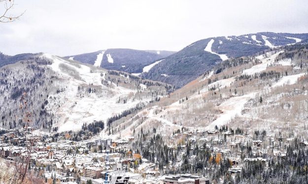
Vail, Beav’ crank up snowmaking as more winter weather on tap

Editor’s note: A fast-moving storm deposited another half a foot of snow overnight Wednesday into Thursday, with Keystone reporting 7 inches new Thursday morning. Keystone announced it’s expanding to North Peak on Friday, with five chairlifts, 80 acres of skiing and two separate peaks for early-season skiing.
Following a steady period of snowy, colder weather over the last week or so – and with more snow in the forecast for the coming week – Vail and Beaver Creek are both already making snow and looking to ramp up operations in coming days.
“We have begun making snow on Golden Peak [at Vail] and will look to begin making snow on the main mountain soon,” Vail and Beaver Creek spokeswoman Hannah Dixon told RealVail.com on Tuesday.
Vail, which saw 8 inches of natural snow on Monday, is scheduled to open for the season on Friday, Nov. 15.
“Snowmaking has begun at Beaver Creek as well,” Dixon added. “Thanks to the favorable temperatures, we are making snow on the racecourse in preparation for Birds of Prey, in addition to making snow on the front side in preparation for opening day on Nov. 27.”
The annual Birds of Prey men’s World Cup races are slated for Dec. 5-8 at Beaver Creek.
All the wet, cooler weather has allowed Loveland Ski Area to set a Friday, Oct. 25 opening day, joining Keystone and Arapahoe Basin, which are already up and running for the season.
Breckenridge and Copper Mountain are scheduled to open on Friday, Nov. 8, with more snow on the way leading up to the first week of November.
“Wednesday will bring a few snow showers to the northern mountains, then a fast-moving and strengthening storm should bring about 12 hours of snow to the northern and eastern mountains from Wednesday late afternoon to Thursday early morning,” Opensnow.com meteorologist Joel Gratz wrote Wednesday morning.
“Accumulations will range from a few inches west of the divide to over a foot east of the divide, and the best powder will be Thursday morning,” Gratz added. “The next storm could bring snow from Sunday through Wednesday, again favoring areas near and east of the northern divide.”
After a windy, warm and dry start to October, recent cooler, wetter weather has allowed law enforcement officials to lift a fire ban in Eagle County. Here’s that press release:
Fire Restrictions to be lifted in Eagle County
Fire managers and
officials with state and local agencies have partnered and agreed to officially
lift all fire restrictions in Eagle County beginning Wednesday, October 23,
2019 at 6:00 a.m.
Recent fire restrictions had prohibited campfires, smoking in certain areas,
cutting, welding, and/or grinding near dry vegetation, operating certain types
of vehicles without spark arrestors and the use of steel core or jacketed
ammunition. Please keep in mind that the use of exploding targets, tracer rounds,
steel core ammunition or fireworks remains prohibited on all federal lands at
all times.
Eagle County fire officials agree that with the recent moisture, increased
humidity and cooler overnight temperatures have helped to reduce the current
fire danger. Officials still recommend using precautions as conditions remain
dry and diligence is always needed in ensuring campfires are completely out,
and watched closely when in use.
Going into the weekend and with hunting season upon us, the Eagle County Sheriff’s
Office would like to encourage everyone to have fun while recreating outdoors,
keep safety in mind and to encourage residents and visitors to take personal
responsibility and prepare before a wildland fire occurs.
View more information about fire restriction in Eagle County at www. ecemergency.org
View fire information across the state of Colorado http://www.coemergency.com/p/fire-bans-danger.html


